Cottonwood Creek Trail
Big Horn County, Wyoming
Overview
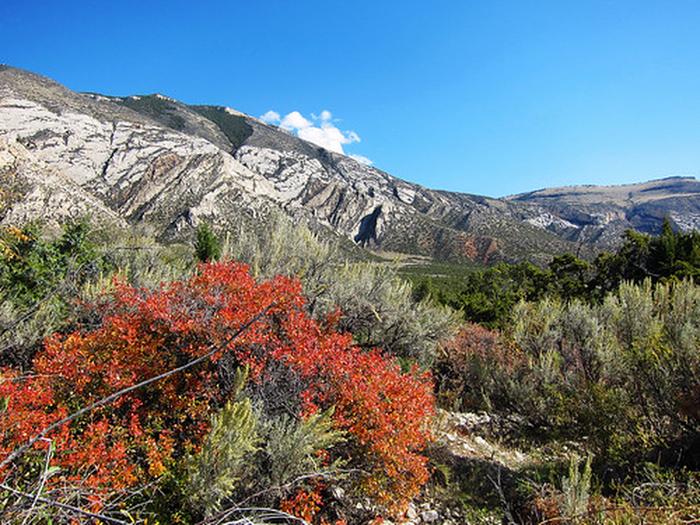
This highly scenic trail is suitable for hiking and horseback riding (advanced riders). Cottonwood Canyon has steep, vertical cliffs. The elevation at the mouth of the canyon is 4,800 feet with the top of the canyon wall at 7,200 feet. At the upper end of the trail, the elevation at the creek is 7,000 feet and the top of the canyon wall is 7,900 feet. The trail is about 4 1/2 miles long and winds through BLM-managed public land, Bighorn National Forest land and State of Wyoming land. The trail accesses the Bighorn National Forest where one can continue hiking or horseback riding on primitive roads and trails. Vegetation in Cottonwood Canyon include narrowleaf cottonwood, willow, waterbirch, red osier dogwood, big sagebrush, juniper, mountain mahogany, Rocky Mountain maple, Indian ricegrass, ninebark, limber pine, Douglas-fir, aspen, and bluebunch wheatgrass. Things to note: Bring drinking water as Cottonwood Creek disappears underground at times. If using water from the creek, filter it or otherwise treat before drinking.
Amenities
- WaterNo
- ElectricNo
- PetsNo
- ReservableNo
Conditions
Live conditions for this spot aren't wired up yet. Until they are: check the forecast for Big Horn County, Wyoming, pack layers, and leave word with someone before you head out.
Reviews
When accounts launch, this is where trip reports, ratings, and field notes for Cottonwood Creek Trail will live — real notes from people who actually went, not star averages from nowhere.